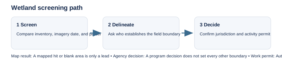
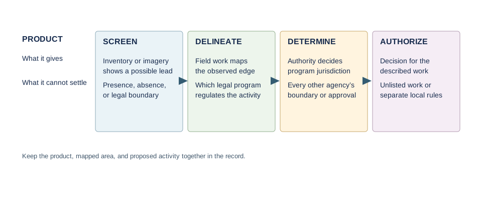
A wetland inventory helps locate a question. It does not establish that a wetland is absent, set a surveyed boundary, or decide which agency regulates the proposed work. Keep four steps separate: screening, site delineation, a program-specific jurisdiction decision, and authorization for the actual activity.
Match the map to the regulator
Record the layer, imagery or study date, map purpose, and parcel area searched. The U.S. National Wetlands Inventory and Canada’s National Wetlands Inventory are screening sources with coverage and source-data limits. State and provincial maps have their own meanings: New Jersey describes its mapped wetlands as approximate and provides a Letter of Interpretation route; Alberta’s policy can require a professional wetland assessment and activity-specific authorization. Ask the local or provincial authority whether a different local inventory controls.
Resolve the boundary and jurisdiction
If the project may fill, excavate, drain, or alter a wet area, ask which authority decides the boundary and which legal program applies. In the United States, federal Clean Water Act jurisdiction follows the current WOTUS implementation for the state and the Corps district; EPA’s current status page notes that implementation differs with litigation. The September 2026 supplemental rule is proposed, so do not apply it as an adopted rule. State, Tribal, and local protections may be separate.
New York illustrates why a determination and a boundary survey are different: a Parcel Jurisdictional Determination answers whether regulated wetlands or adjacent areas are present within the requested area, while a field delineation establishes their extent. A later Project JD addresses the proposed activity. Other states use different products and review steps; a result from one program does not settle another.
Ask about the proposed work
Give the agency the parcel boundary, access, grading, drainage, and building footprint. Ask whether a field delineation, formal determination, permit, or exemption review is needed, which mapped or unmapped waters are in scope, and whether the local authority must also review. Keep each written response with the map version used. A wetland screen does not decide ADU feasibility; see the New York DEC determination guide for that state’s distinct process.