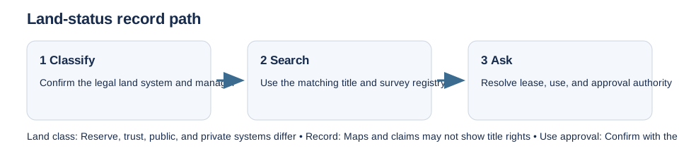
Before relying on a municipal parcel map or ordinary title search, establish what land system governs the site. A civic address, tax parcel, mineral claim, or public-land viewer may not identify the ownership, land manager, lease, or consent route needed for a dwelling project.
In Canada, Natural Resources Canada’s survey and land-record guidance is specific to First Nation lands managed under the Indian Act. It does not cover every Indigenous governance or landholding arrangement. Confirm the actual reserve or land regime, relevant First Nation authority, survey record, and any land-use or lease instrument with the appropriate office.
For U.S. trust or restricted land, the Bureau of Indian Affairs’ Branch of Land Titles and Records maintains federal title and encumbrance records for its stated scope. Tribal authority and land-specific records may also be necessary. On federal public land, BLM’s Mineral and Land Records System serves land and mineral record searches; a mining claim or case listing is not proof of surface title or residential permission.
Ask which authority controls the legal description, boundary, lease, access, and proposed use. Obtain the underlying survey, title instrument, allotment or land-status record, and written land-manager response. Keep environmental, cultural-resource, and public approvals separate. The general parcel and authority guide explains the first parcel-matching step.