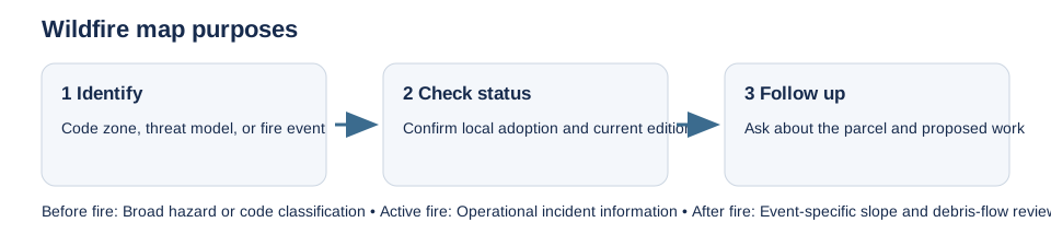
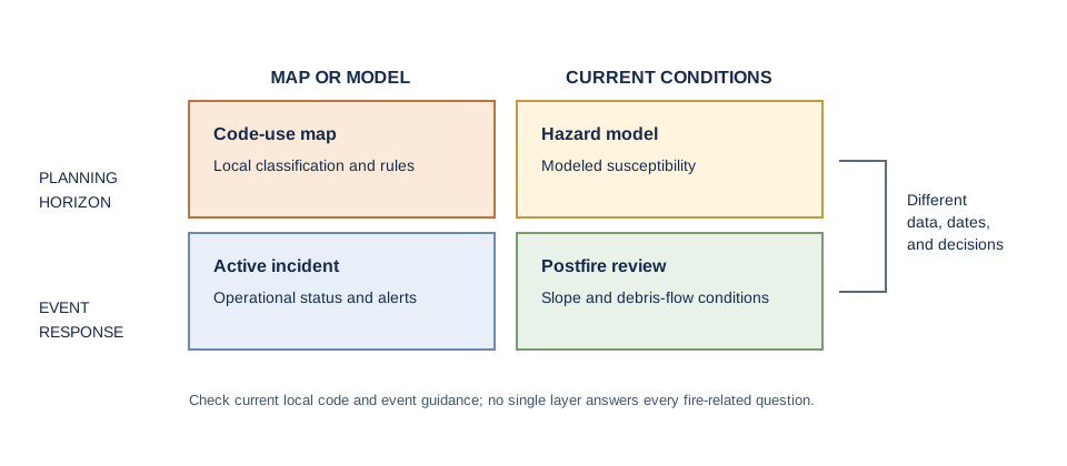
Wildfire products can describe modeled hazard, building-code jurisdiction, current fire activity, or a postfire debris-flow scenario. Those meanings are not interchangeable. Start by identifying the exact map, issuing agency, adoption or data date, and the decision the map supports.
California Fire Hazard Severity Zone maps classify modeled hazard for state or local responsibility areas; confirm the adopted status and local building-code route with the responsible authority. Washington’s WUI layer is tied to its stated code and planning use, while British Columbia’s Provincial Strategic Threat Analysis is a broad threat model. Canada’s CWFIS supports operational fire-information needs; it is not a property-level building-code decision. Oregon’s former statewide wildfire hazard map is no longer in effect, so check current local code adoption rather than relying on that repealed layer.
After a fire, a postfire debris-flow map is a separate, event-specific product. USGS assessments may identify locations with modeled debris-flow potential after rain on burned slopes. A prefire hazard map does not replace that event assessment, and a postfire model does not establish the condition of a particular lot.
Confirm the project route
Ask the local planning or building office which adopted wildfire map and code apply to the parcel and proposed work. Where recent burning, steep terrain, or mapped debris-flow potential is relevant, ask the responsible hazard agency whether a current local assessment exists. Record the dataset version and consultation date. A map does not determine insurance availability, site safety, evacuation access, or permission to build; those questions need their own current sources and authorities.